Panama
Canal Basics
Between 1881 and 1888, France started construction of a sea
level canal through the Isthmus of Panama. Due to a number of
factors, including desease, this effort failed and was abandoned.
In 1904 the United States took over the construction, after
conquering the mosquito problem which caused most of the desease, and
completed the canal in 1914. It was deemed that creating a sea
level canal was impractical and it was decided to make the canal 85
feet above sea level, with a series of locks at each end to raise and
lower ships to this level. Three locks accomplish this at each
end of the canal. At the Pacific end there are two locks at
Miraflores, and one at Pedro Miguel. At the Caribbean end the
Gatun Locks consist of all three required locks. All the locks
were built with two lanes of locks side by side. Initially it was
felt that one lane would be used for northbound ships and the other for
southbound. It was quickly decided that it was more efficient to
have both lanes used for inward bound ships in the morning and outward
bound ships in the afternoon.
You may have noticed that I referred to north and south as the
directions of travel. The isthmus is twisted to run east and
west, so the transit is north and south. As a matter of fact it
is somewhat northwest and southeast. This means that a ship
heading from the Pacific to the Caribbean is actually moving westward
during the transit.
On December 1 we made the transit through the canal to the
Caribbean. It is pretty much an all day event to travel the 51
miles of the canal, starting in Panama City, traveling several miles
through a channel to the Miraflores Locks, another several miles to the
Pedro Miguel Locks, 8 miles through the Culebra Cut and into Gatun
Lake. More than half the transit is in Gatun Lake to the Gatun
Locks. A few more miles in a cut channel exits into the Caribbean
at Colon.
The lock system runs entirely on gravity. There are no pumps to
raise and lower the locks. All the water is drawn from Gatun Lake
to fill the locks and the drained water from the locks flows down into
the ocean. Panama has a very high rainfall (about 100 inches per
year) and it is ths water that keeps the canal operating. It is a
good thing there is so much rain, as each passage of a ship uses about
55,000,000 gallons of water from the lake.
The Coral Princess in what is know as a Panamax ship. It was
built to the maximum size allowed by the canal. (Actually it is 6
inches shorter than the max length at 964.3 feet). Its width is
the maximum of 106 feet. As the canal locks are 110 feet wide
this allows a 2 foot clearance on each side of the ship.
It is very expensive to go through the canal. For our
ship there was a berth charge of $134 for every occupied berth and $107
for every un-occupied berth. Our ship contains 3290 berths
considering passengers (2368) and crew (930). We were fully
booked, so our toll was about $440,860. In addition there are
fees for a number of other required services such as tugs, mules, and
inspectors. The lowest fee ever was 36 cents for Richard Halliburton, an American explorer, who swam the canal in 1928.
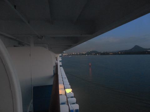 |
We are approaching the canal entrance just about sunup.
|
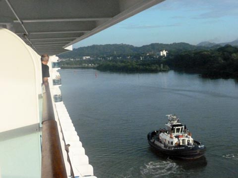
A pair of tugboats escorted us to the first
locks. They are there just in case conditions prevent the ship
from maintaining control on its own.
|
 |
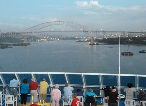 |
We are approaching The Bridge of the
Americas. Until a few years ago this was the only permenant
bridge across the canal. The Pan American highway crosses this
bridge and allows you to drive from Panama to Alaska. To the
south there is a 40 mile break in the higway preventing a drive to
Colombia.
|
During the entire transit, one of the cabin
TV channels showed images from a camera over the bridge. Often
this gave the best view of what was ahead. In addition, our
historian was giving nearly constant information on the canal and our
passage.
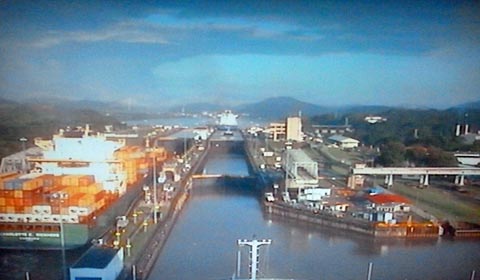
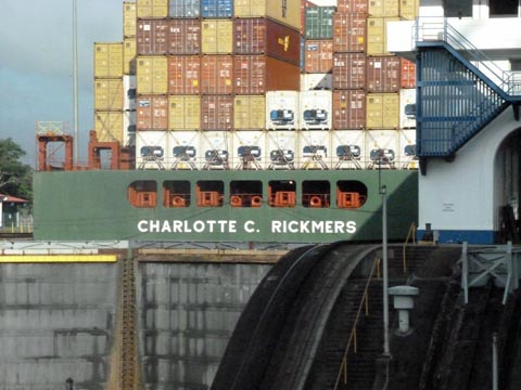
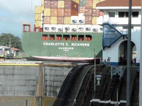
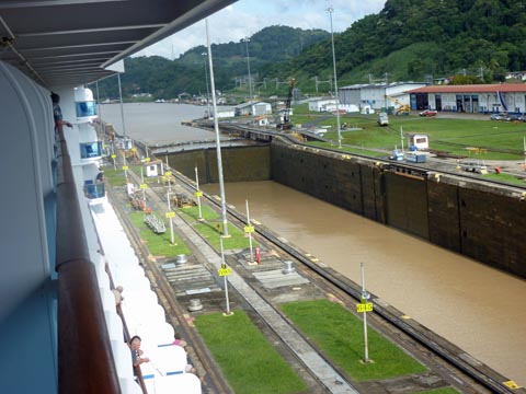
Here we are approaching the Miraflores locks. They are two locks
wide by two locks long. There is a container ship just entering
the left hand lock.
This is a photo of the cabin TV screen.
|
 |
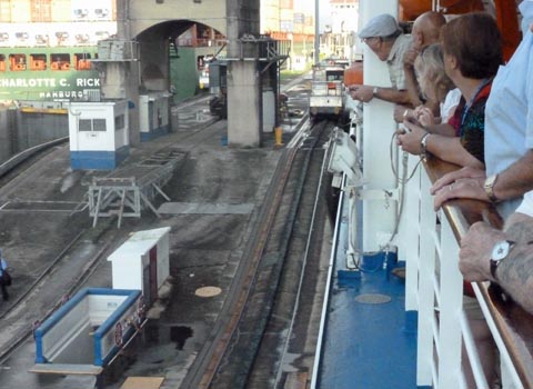 |
The railings were packed as we entered the first lock.
|
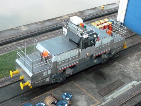
These elictrically powered canal engines (or mules) are very
important. They attach to the bow and stern of the ship on both
sides and using a very powerful winch, control the position of the ship
between the sides of the locks. They are also used for stopping
the ship in the correct position in the lock. The ship provides
its own propulsion through the locks. There is a speed limit of 2.5 knots.
Large ships like ours use 8 of these mules; 2 on each side of the bow and 2 on each side of the stern.
|
 |
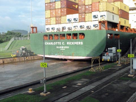 |
Here the container ship is entering the lock.
|
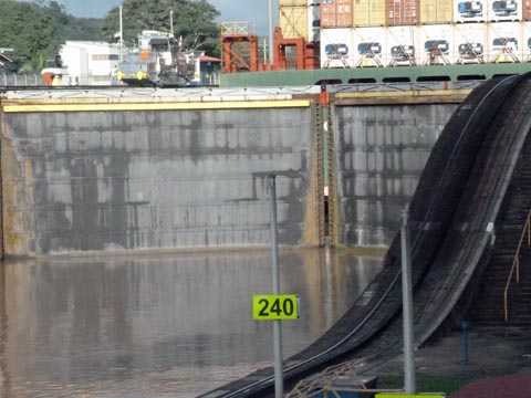
Now in place in the lock, the gates are almost closed.
|
 |
 |
As water is let into the lock, the ship is rising.
|
Here the lock is full of water and the ship as at it maximum height, ready to pull out of the lock
|
 |
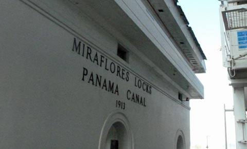 |
The Miraflores locks were completed in 1913.
|
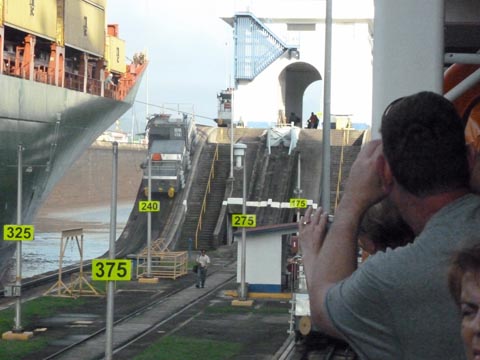
As the ships rise in the locks, the mules
must rise also. Here one of the mules is halfway up the very
steep incline to the next level.
In addition to having powered wheels, the mules are driven by a rack
and pinion system. There is a rack running down the center of the
track for all the areas where ships would be attached. The engine
has a pinion gear that engages this rack for positive, non slip
traction.
For the switching yard and storage yards, this rack is not used.
|
 |
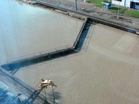 |
Here we see a pair of lock gates closed with
the water level equal on both sides. This is the only condition
where the gates can be opened.
|
We are in the third lock of the system, the
Pedro Miguel lock. We are about to sail out at 85 feet above sea
level to go the majority of the way across the isthmus.
|
 |
To continue to Panama Canal part 2, click
here.
<BACK>
|