Hi all,
The other glitch was
that in talking to the rangers at
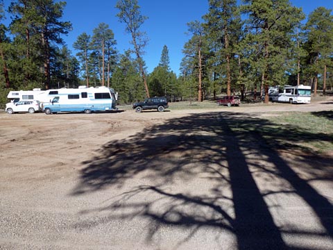
On this trip are Doug and Janet, Ray and Kathy, Tom and Marilyn, Dick and Alice along with their daughter Suzanne, and Rosemarie and Dick (that’s me), and their 5 rigs.
We left home at
about
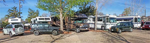 |
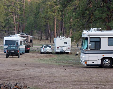
These are
our rigs at our Kanab RV park. |
Tuesday April 18
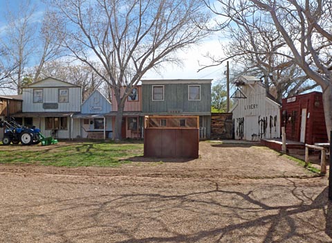
This morning we all went over to the local Visitor’s Center and got maps and information on area attractions and nearby points of interest. From there we went to a movie museum which had a number of actual sets from movies on display. There were a lot of movies, mostly westerns, shot in the Kanab area, and many of the sets had been moved to their property. They also showed where other sets could be found nearby, including the set from the TV show Gunsmoke. Unfortunately, many of these sets are on private land and the owners appear to have no interest in keeping them up, so they are continuously deteriorating and the owners will not let people in to see them. As we would only be able to see them from a public road some distance away, and they are in poor shape, we skipped that one. What we did see was very interesting.
| The
sets at the movie museum were all actual sets used to film movies.
Most of the buildings had a tag identifying the movie and the
major stars. |
 |
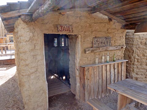 |
This is the jail, one of several adobe buildings. When I asked the lady inside how they moved these buildings, she said to look closely. The "adobe" was really a siding. When I looked around the door where some calking had come out, I could see that it was about 1/8 thick and looked almost like paper mache. You can never tell by appearances. |
After arriving back at camp, one of the couples mentioned having reservations to take a tour of an animal sanctuary nearby. It included a 90 minute narrated bus ride around their facilities. It sounded interesting, so they called and were able to make reservations for the rest of us.
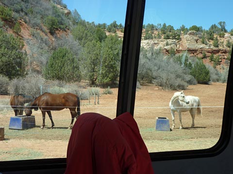
| As
we were on the bus tour at Best Friends, we saw a number of horses,
some with physical or mental problems. |
 |
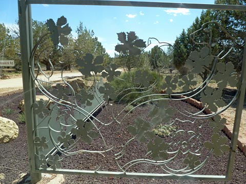 |
At
the entrance to the dog area we passed by this gate which was made by
one of their volunteer artists. At first glance is is some
interesting leaves, but as you look at it, you can see a number of dog
heads. It's too bad the background is so busy, as it makes it
hard to see some of the heads. The dog area was massive with a great many buildings, most of which were octaginal, as they decided this was the most efficient. They have 8 pens around a central area, and all can be checked from this area. They appear to keep 2 or 3 dogs in each pen, sometimes in their crates. All these buildings are surrounded by dog runs for the dogs to get their exercise and sunshine. |
| Marilyn, Janet and Doug are looking at one of the rooms in one of the 13 cat buildings. All buildings have many places for the cats to climb and snuggle. Every room has cat doors to let the cats out the their outer pens. | 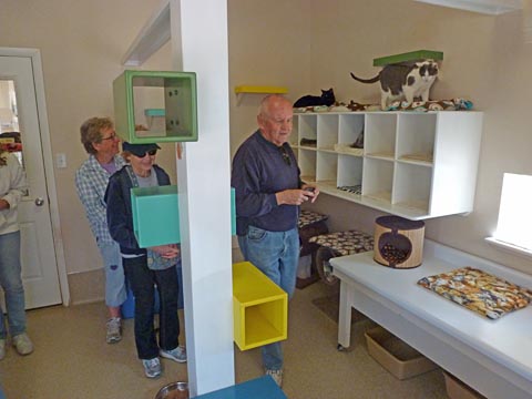 |
After we left the
gift shop at Best Friends, we went about a
mile down the road to the
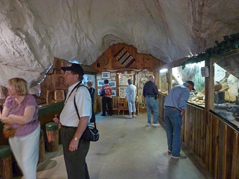 |
Here
we see Kathy, Ray, Janet, Rosemarie, Marilyn, Doug, and Tom looking at
artifacts. Dick is behind the camera. The cave contains a couple of rooms in the back. This is the museum containing Indian artifacts, dinosaur foot print fossils, and other relics of the area. In another back room was a massive display of minerals which fluoresce. That room was so dark with just the glowing rocks, that I was unable to get any pictures other than color smears. |
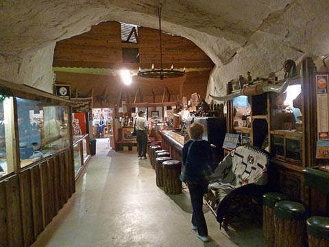
The museum room contains the prohibition era tavern. You can see one of the bars and the stools near the center of the picture. The other bar is just out of the picture to the lower right, but you can see several of the stools. |
 |
This evening the 8
of us went out to dinner. The
place we had picked turned out to be open
Thursday through Monday. This
was
Tuesday. We went
about a block down the
street and had a wonderful dinner at
Wednesday, April 18
Today most of us
loaded into 3 cars and headed for the Coral
Pink Sands State Park, which is only about 20 miles from Kanab. The sand dunes consist of
very fine coral
colored sand. If
you pick up a handful
of sand and let it out slowly, it almost looks like a mist. This is a
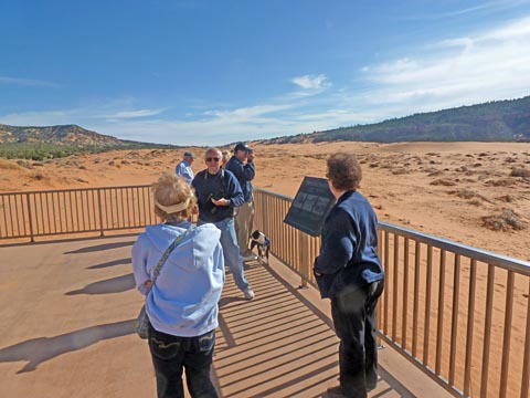 |
A
number of our group are on the observation deck viewing the dunes at
the Coral Pink Sand Dunes State Park. |
| The dunes are a bright salmon color and extend almost as far as you can see to each side. | 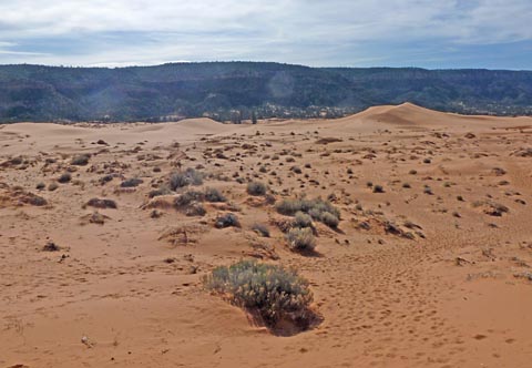 |
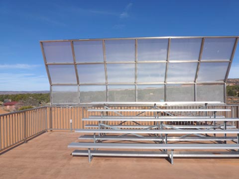 |
The observation deck is amazing. There is a very sturdy aluminum railing all the way up the path and around the deck. This set of bleachers with its protective screen was nothing I would expect. |
| The sand is interesting to walk on. There is just some extra resistance on level areas, but on slopes your feet sink in and slide down some. It almost feels like they will be burried in the sand. | 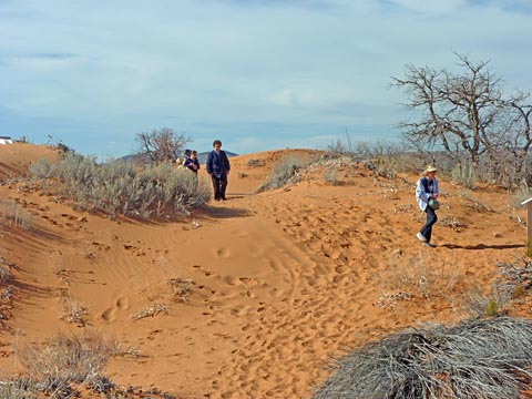 |
From there we
traveled about 30 miles, including a couple
stretches of dirt road to the
We toured
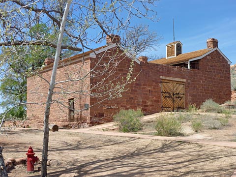 |
This
is the fort (Windsor Castle) from the outside. The massive
gates
lead into the courtyard and the little structure on the top is the
observation tower. |
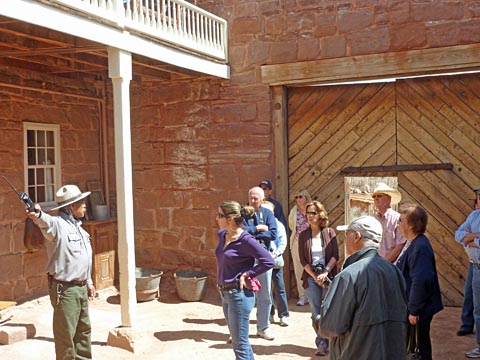
| The
members of our tour group are listening to the history of the fort as
told by our guide. The fort contained living quarters for
quite a
few people including a kitchen and a water cooled pantry. |
 |
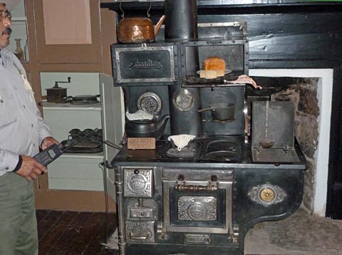 |
The
kitchen included a beautiful wood stove, and a couple dining
tables. |
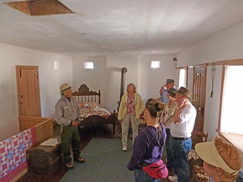
| There
were several bedrooms. This one has gun ports along the top
of
the 18 inch thick walls, and a climb hole to the observation tower.
None of these were ever actually used as the Indian raids had
pretty well quit by the time the fort was completed. In the fields around the fort they built up a very large herd of cattle. Texas Longhorns did very well in this area. |
 |
 |
The
fort was the location of the first telegraph station in the territory.
It was operated by a woman at this table. The fort was originally thought to be in Utah, but a later survey showed it to be just inside the Arizona boundary. |
Tonight we all participated in a pot luck dinner and no one left hungry!
Tomorrow
we will leave this beautiful campground and head to
some BLM land on House Rock Road in preparation to 4 wheel off road
exploring
the Paria Plateau. We have decided that 2 nights here should
be
enough. We will only do the back roads for one day.
We also
decided to stay at Page for 3 nights, instead of 4 we had originally
planned.
Thursday, April 19
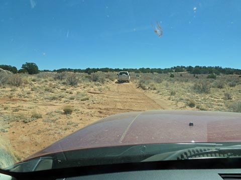
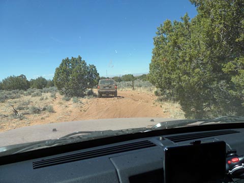
We got up, ate a leisurely breakfast and got ready to leave. We said our sad farewells to Dick, Alice, and Suzanne as they were heading for home this morning. After several of us fueled up, we departed for our next stop near House Rock Road and US89A. This is near where we will start our off road adventure on the Paria Plateau tomorrow. As we approached the area, we all pulled off in a large scenic view parking area, un-hooked Doug’s Jeep, and the 4 of us guys went exploring for a good spot to stay. There is a lot of BLM and forestry land around here and we can stay, within guidelines, almost anywhere that is flat and already disturbed. We cannot be the first disturber.
We
drove to a small flat area just off US89A where the ranger in the
Forestry office had suggested. It contained a sign "No
Overnight
Parking". We assumed the sign trumped the ranger.
We found
a site that could work, but was not ideal, right along 89A.
We
then drove up House Rock Road, a fairly major unpaved road which
extends from US89 in Utah down to US89A in Arizona. It is
from this
road that our route will start. We were told we could park
anywhere along this road, past the initial ranch, using the same
guidelines. Unfortunately, there was absolutely no place
where
the shoulder and brush would allow an RV to park, and there were no
pre-disturbed areas.
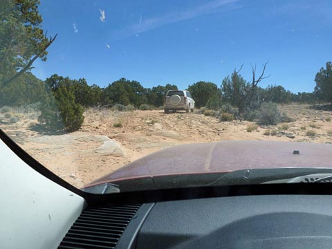
Doug and Janet had made notes of appropriate camping places as we had been approaching, so we picked up our RV’s and backtracked to a very nice place among the Pine trees at about 7500 foot elevation where a couple of forest roads joined US89A.
| The
site we found was in the pines and was beautiful. At 7500
feet, the nights were below freezing. |
 |
Friday, April 20
This morning Ray came over and told me that he and Kathy were heading to Page shortly, as he was having an electrical problem and they were having some problem with the altitude. We will meet them there tomorrow.
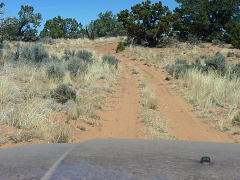
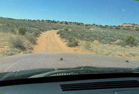
About 8:30 the remaining 6 of us left camp in our 4x4 vehicles. Doug discovered that one of the roads leaving our “camping clearing” connected with House Rock Road somewhat north of our turnoff, so we went that route. Our plan was to follow forest and BLM roads to the top of the Paria Plateau and out to the end. There are some tremendous views from the end. The drive, once we reach the junction of House Rock Road and the entrance to the Plateau is about 30 miles in and another 30 miles back out over the same route. As we drove through the forests and down to the junction was about another 15 miles of dirt roads, and after we returned, it was about 10 miles down to US89A. We drove about 85 miles on unpaved roads today on a route that took us a little over 8 hours. I think we all felt the results when we returned to our rigs!
The roads ranged, as Doug put it from “super highways” to "not so good". There was a lot of sand along the route, much more than the reports had indicated. Early on, I thought I had experienced a mechanical failure when the car made a loud thump and then would just barely move at full throttle. It turned out that I was in deep sand, and had apparently hit or dropped off a rock as I hit the deep sand. Once I plowed my way for about 20 or 30 feet all was well, and I began to suspect that it had just been the drag of the sand. I later confirmed all of this.
 |
The
forestry road out of our "campground" was quite nice. It was
about a 15 mile drive to our starting point on House Rock Road. |
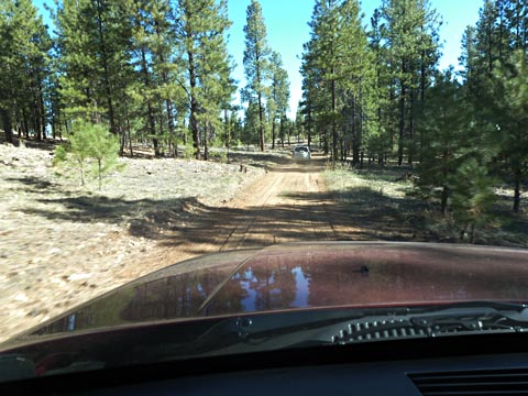
| We
have just reached our turn off onto the plateau and are starting toward
the overlook at the end. |
 |
 |
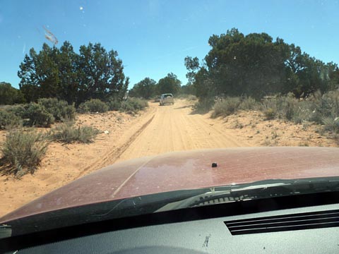
The
road varied greatly. We found a number of places where the
rock strata was projecting out of the sand. I am following Tom and Marilyn for the first half as we head out. |
| This
road was no better. |
 |
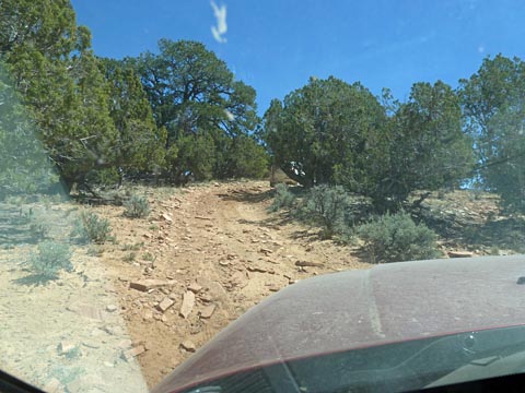 |
Sometimes
it got downright horrible! |
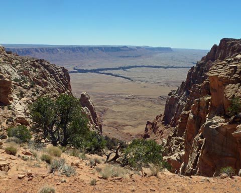
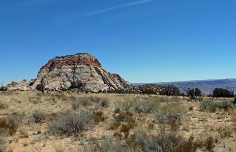
| About
two miles from the end, we reached the overlook to Marble
Canyon. It was just gorgeous! |
 |
 |
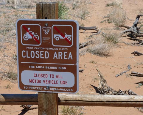
As
we approached the end of the plateau we were getting more and more
excited. |
| OH
NO! About a half mile from the end, we came to barricades and
this sign. What a disappointment! |
 |
 |
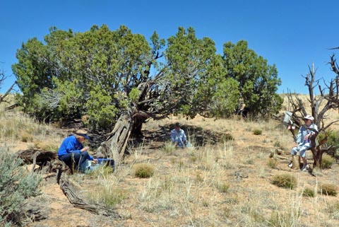
From
the end of our
road, we could see the Paria Needle. We had hoped to drive
around
to the other side of this for a panoramic view of the Page - Lake
Powell area. |
| Instead,
we had a picnic! |
 |
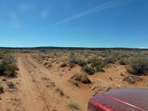
We then turned around and started for home. Things were going well until about a third of the way back I approached Doug, who had been out of sight for a bit. He was stopped half way up a sandy slope. He was stuck! Tom and I helped him dig sand out from under his tires, put rocks, buried in the sand under his front wheels, put mats under his rear wheels, and after several false starts, with the aid of Tom and me pushing, he eased his way up to harder ground.
Next it was my turn. I backed up from where I stopped and tried going up. I just mushed slower and slower until I could not move – forward or backward. We dug sand from behind my wheels and with a little push I was able to back down to solid ground. I backed up even further then, giving it everything my Jeep has, I hit the sand at a high speed and bounced my way to the top with no problem. Tom did pretty much the same thing and made it to the top. Whew! We didn’t need to “air down” our tires or have to tow each other, although we were prepared to do either.
The rest of the trip was uneventful, but I now had a lot of respect for the uphill sections of sand!
 |
After
our experience
getting stuck in the sand, we didn't have any more problems.
Here I
am following Doug and Janet over a relatively flat section of sandy
road. |
| A
lot more of the road was sand than had been reported in the information
we researched prior to the trip. |
 |
 |
And
yet more sand! |
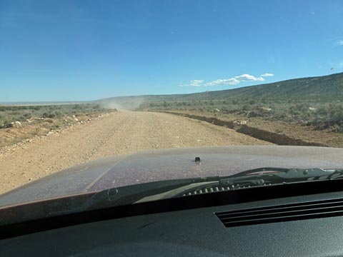
| At
last we reach the
Rock House Freeway! This is a well maintained gravel
road.
In the distance you can see the dust cloud from Doug's car as we head
for highway 89A and smooth blacktop the rest of the way back! |
 |
 |
We
were very happy to
see that our rigs were just as we left them at our camp site.
This picture shows the large clearing which is the transition to two
different forest roads. |
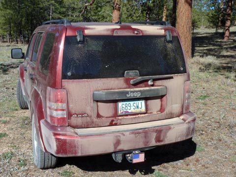
| Upon
reaching our
campsite, most of the thick layer of dust had blown off the rear of my
Jeep. It could still use a car wash. |
 |
Saturday, April 21
We had a leisurely get-up and breakfast this morning. I worked on this report and my photos some. The others went exploring to see if they could see House Rock. There is a forestry road across the highway that is supposed to have a view of it. After a while we secured everything and proceeded to Page. I wanted to get into an Urgent Care center and see if I could get a Cortisone shot for my shoulder, which has been acting up.
It was only about 75
miles to Page. We
pulled into the park and were given the
space which backed up to Ray and Kathy.
After I returned from getting my shot, Tom &
Marilyn and Doug &
Janet were in the spots next to our two rigs.
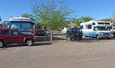 |
The
campground was very nice and we all were parked together. Our
rig
and Doug and Janets are on this row. Ray and Kathy's and Tom
and
Marilyn's are in the row behind us and are harder to see from here. |
This evening we all went into town and had a great Mexican dinner!
Sunday, April 22
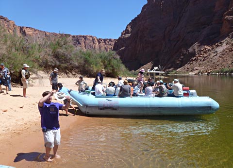
I had made reservations for 6 of us (Ray and Kathy couldn't go) to take a rafting trip on the Colorado River from the Glen Canyon Dam down about 15 miles to Lee's Ferry.
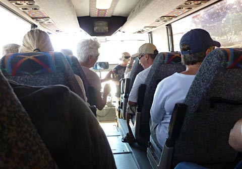
We
drove to the tour company's office and boarded a bus. We
drove a
couple of miles toward the dam, but turned off well before reaching
it. We went through an electric gate and drove down a road to
a
tunnel. The tunnel is 2 miles long and drops at an 8%
grade. It was created during the dam construction to allow
vehicles to get down to the base of the dam. Every 1/4 mile
or so
there is a side tunnel to the left out the cliff. This
provides a
little light and some ventilation. At the end of the tunnel
we
were almost down to the river level, and directly under the 700 foot
high bridge across the canyon. Because we were under the
bridge,
we were required to wear hard hats.
We walked down a ramp to the boat dock where we turned in our hard hats
and boarded a raft. The rafts consist of 4 rubber pontoons
about
3 feet in diameter and 18
feet long. They are strapped together, 2 on each side with a
box
type structure in between. There are padded seats around the
edges of this box and the pilot's console in the rear. There
is a
tread-plate front for boarding. It has a powerful outboard
motor
to move the raft when it is not drifting with the current. The inner
pontoons are located under the seats of the
box, so you can slide outward from the seat to the top of the outer
pontoon to ride. We stayed inside.
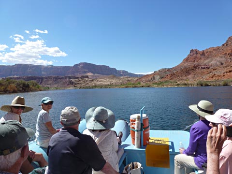
The trip was wonderful! We sometimes putted slowly, sometimes
just floated with the engine off, and sometimes went quite fast, on a
full plane. Enroute we were under cliffs that started at about 700 feet
high. As we progressed, the cliffs got higher and higher,
reaching over 1500 feet. The cliffs had the typical desert
varnish that so typifies the Lake Powell region.
I'll let the pictures tell the rest of the story:
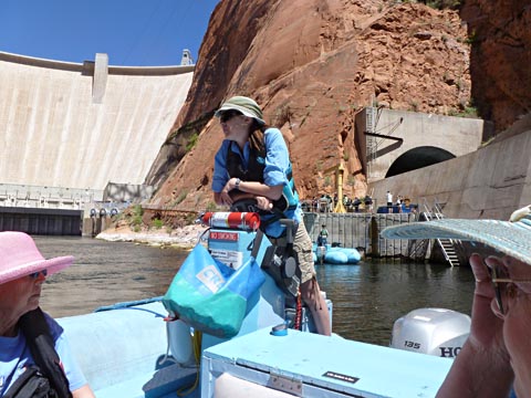
| We rode a
large tour type bus from the downtown office to the base of the dam. |
 |
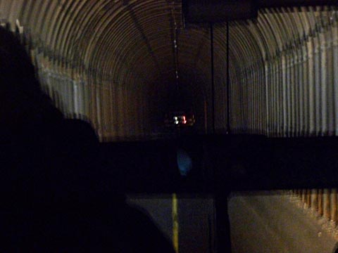 |
The 2 mile
long tunnel is really dark inside! The camera is seeing the
tunnel much better than my eyes did. |
When we boarded the raft we said "This is Floyd's trip, we wish he were here!" so we clicked our heels 3 times and repeated "We want Floyd, We want Floyd, We want Floyd", we looked up and there were Floyd and Ruthie! (Actually this is a picture from our October 2000 trip. Floyd and Ruth were with us on our current trip only in our hearts.) |
 |
 |
Our boat
driver / guide was a college student who is doing this part
time. She was very good. |
| Looking
forward on the raft we can see Janet, Doug, and Marilyn. |
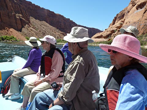 |
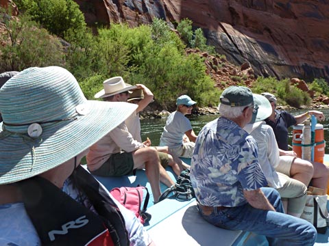 |
To the
left are Rosemarie and Tom. |
| From a
distance, the dam and bridge don't look quite as imposing as they do
close up. |
 |
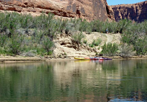 |
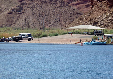
During
our 15 mile trip, we saw several kayaks. Here you can just
see
one of the campers on the ledge above the shore. We also saw
several power boats and several personal rafts. |
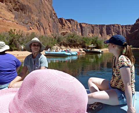
| About half
way, we beached the rafts and got off. Most people hiked up
the trail and ate their lunches here. |
 |
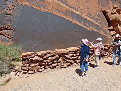 |
At
the end of about a 1/4 mile trail is a wall with a number of
petroglyphs. Here Janet, Marilyn, and Doug are enjoying it. |
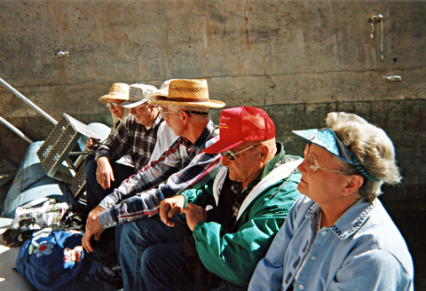
| As
it was quite hot, our guide placed a bucket of lake water on the raft
behind where I was sitting. People could dunk their hats in
the
water to cool off. Actually, I dunked most of the hats for
them. Here at the beach, people had the opportunity to dunk as much as they wanted. Several people waded well out into the water. Our guide submersed herself. The water here is 42 degrees year round! |
 |
 |
As we
approached Lee's Ferry, our surroundings went from high rock walls to
much lower desert terrain. |
| We
are just pulling into the dock at Lee's Ferry. We were happy
to
get on the air conditioned bus that was waiting to take us home. |
 |
When we returned to camp, Ray and Kathy were gone. I had not realized they were moving on to their next stop today. (The others were aware of it.) I am sorry we did not get to say our proper goodbye's!
Monday, April 23
Today, we have
reservations to take a Navajo led tour of the
gorgeous Antelope Canyon. This
is a "slot canyon", cut through the rock by the action of the
occasional flood waters which result from distant
thunderstorms.
They flood several times a year, for maybe a total of 2 hours a year on
the average. This has resulted in a very deep cut of
approximately the same width for its entire depth. The Grand
Canyon was cut as a slot canyon. The river etched its way down as a
constant width cut. It was the action of the elements which
then
started eroding the sides above the water level. Landslides,
grinding of the walls by airborne grit particles, and the effects of
rain and freezing all contributed to the gradual failures of sections
of the side walls resulting in the very wide, very beautiful Grand
Canyon.
For reasons I am unclear about, the slot canyons fail to start this
erosion process on the side walls and remain basically parallel (on the
average, but certainly not at any specific point).
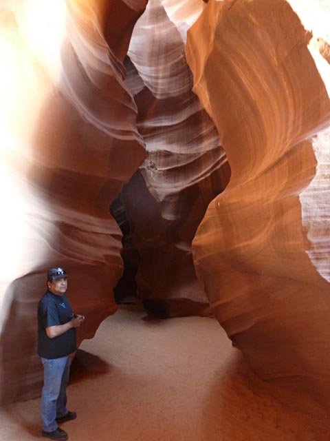
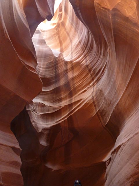
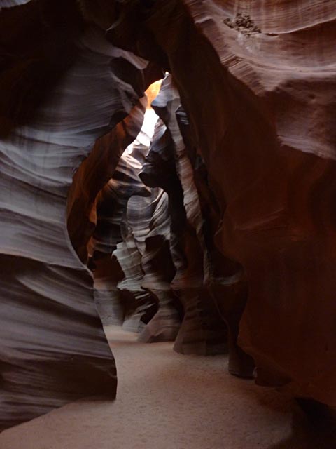
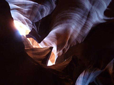
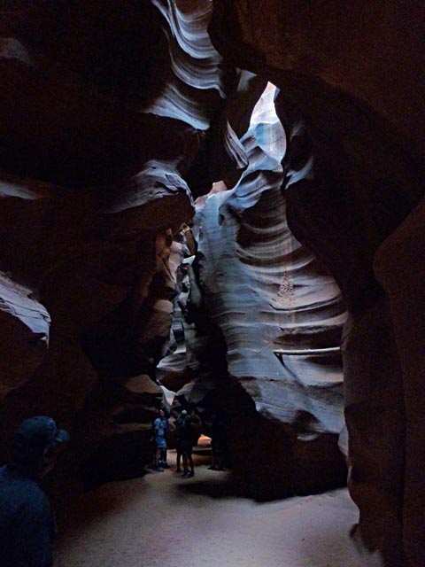
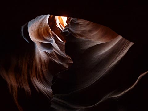
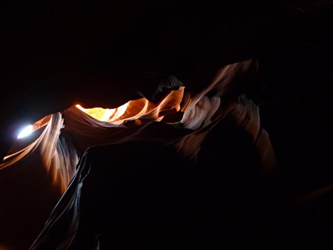
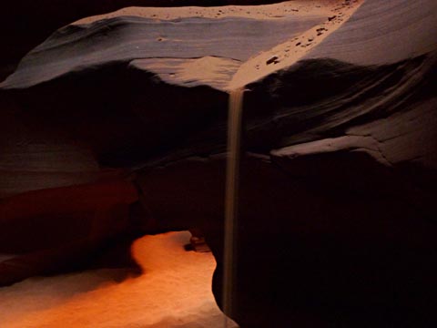
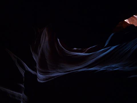
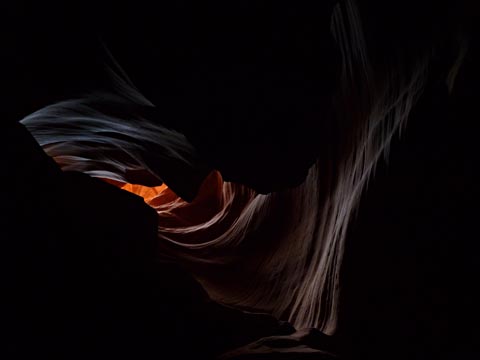
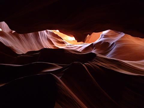
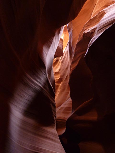
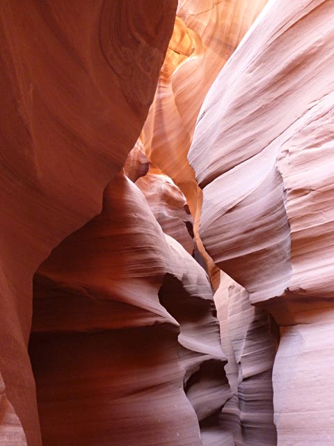
Antelope Canyon is spectacularly beautiful, consisting of a slot about
120 feet deep with a width of typically 4 to 6 feet, with occasional
spots at maybe several times that. It is about 1/4 mile
long. The two ends of the canyon are sheer walls of stone,
with
the floor of the canyon about at the ground level, making entrance very
easy.
Its walls meander and swirl with an amazing variety of colors and
textures caused by the varying angles and amount of sunlight that
penetrates the canyon, and the different flow patterns of water during
the flood times. Areas of the canyon are almost totally dark with no
visible sky, and sidewalls illuminated only way above you.
Other
areas are very brightly lighted with several large patches of sky
visible.
This canyon is unique among the many slot canyons in the area due to
its flat floor. It is a common trait of slot canyons to have
large steps in the level as the water flows through. Usually
these steps are 10 feet or more of sheer drop, numerous places through
the canyon. The level floor here makes it accessible to us
common
folk.
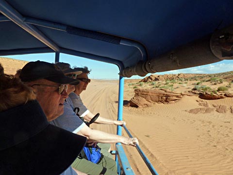
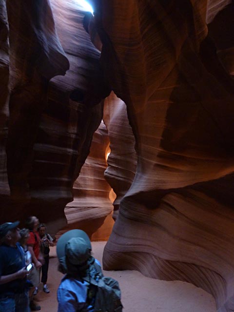
We met at the tour office, were loaded onto seats in the back of an open truck, and driven out to the canyon. The last part of the drive was over a large area of soft sand. (Been there, done that!)
Our guide was great! As he was describing the canyon and pointing out features, he would point his flashlight to a specific spot on the floor and say "Stand there, put your shoulder against here, point your camera there", and it would always be a great shot!
These pictures don't
really do the canyon justice, but do
show some of the beauty that we saw. Once we get into the
canyon I won't try to comment on each picture.
 |
On our way
out to the canyon, we drove right by our campground. |
| As
we bounced our way over the sand, not unlike what we did on the Paria
Plateau, Doug confessed it was a lot more fun when he was driving! |
 |
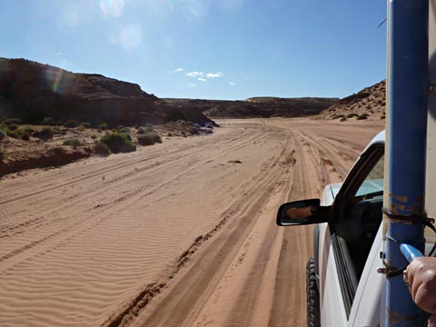 |
The "road"
to Antelope Canyon is really just a wide expanse of sand for about the
last mile or so. |
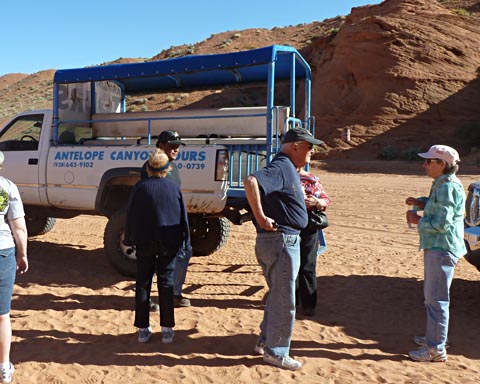
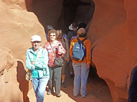
| Our truck
was full coming out. Here we see just our group after
disembarking. |
 |
 |
 |
 |
 |
 |
 |
 |
 |
 |
Part
way through the canyon, our guide picked up a handful of sand and
tossed it onto this ledge. He said he did this to show us how
fine the sand is. It poured down in this stream for about 30
seconds. |
 |
 |
 |
 |
 |
|
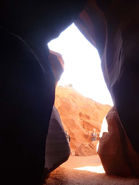
| When
we had the exit of the canyon in sight the guide asked me for my
camera. He called out and asked people to move away from the
opening, carefully aimed my camera and took this picture shaped like a
bear. (Hint, squint a little.) |
 |
 |
Marilyn
and Rosemarie are walking out the end of the canyon. |
When we finished our guided tour through the canyon, we lounged a little outside the end, then on our own walked back through to the entrance, and onto our truck. The tour was about and hour and a half. Afterwards we went to breakfast at a great little cafe in Page. I then spent much of the rest of the day working on this report.
Tuesday, April 24
We got up and went to Denny's for breakfast. This is the 2nd breakfast there since we got to Page. For $2 I had a biscuit and gravy and hash browns. It was just the right amount of food for me, and you can't beat the price.
We went back to camp, packed up the motorhome, said our goodbye's to Tom, Marilyn, Janet, and Doug and headed for home. We were the last to pull out, but just out of town we passed Doug and Janet pulled over to take pictures. A few miles later, we passed Tom and Marilyn on the highway. I had promised Rosemarie that we could stop at the Cameron Trading Post on the way home. Shortly after parking there, in pulled Tom and Marilyn.
The drive home was uneventful and we got here about mid afternoon.
It was a wonderful trip with wonderful friends. We missed you Floyd and Ruth!Dick
Sad Postscript:
On June 3, 2012, Floyd passed away. We will miss you Floyd!
| |